Sehenswertes
natur
Berge, Lagunen und wilde Wanderwege.
90 Orte in 9 Orte
Nach Ort entdecken
Wo man natur findet
Wählen Sie einen Ort auf der Karte, um nur seine Plätze zu sehen. Größere Punkte haben mehr Plätze.
Alle natur
Es werden 24 von 90 angezeigt
-
Algar Seco
Carvoeiro
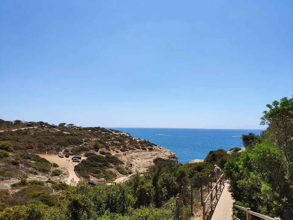
Rock formations, sea arches and a blowhole on the cliffs east of Carvoeiro. The clifftop boardwalk starts at the small fort of Nossa Senhora da Encarnação and reaches the rocks in about 750 metres from the centre of Carvoeiro. Keep to the paths; the cliff edges are unstable.
Foto: Manuel Alende Maceira, CC BY 2.0 (Wikimedia Commons)
-
Alte Waterfall
Loulé
Waterfall in Algarve, Portugal.
Foto: Magikknox, CC BY-SA 3.0 (Wikimedia Commons)
-
Benagil Cave
Ferragudo
Benagil is a small Portuguese village on the Atlantic coast in the municipality of Lagoa, Algarve, in Portugal.
-
Cabo Carvoeiro
Carvoeiro
Cape in Faro District, Portugal.
Foto: This illustration was made by Rašo. An email to Rašo would be appreciated too., CC BY-SA 3.0 (Wikimedia Commons)
-
Cabo de Santa Maria
Faro
Southernmost point of mainland Portugal.
Foto: No machine-readable author provided. OsvaldoGago assumed (based on copyright claims)., CC BY-SA 3.0 (Wikimedia Commons)
-
Carvalho beach Carvoeiro
Ferragudo
Here, an angular cut in the coastline shelters a small, welcoming bay lined by deeply-eroded ochre rock walls. A huge, scenic rocky ledge marks the central line of the beach, dividing the horizon. The cliffs remain high along the entire len
-
Culatra Island
Olhão
Island.
Foto: No machine-readable author provided. OsvaldoGago assumed (based on copyright claims)., CC BY-SA 3.0 (Wikimedia Commons)
-
Fóia
Monchique
At 902 metres, the highest point in the Algarve, in the Serra de Monchique. A paved road reaches the summit, which has telecommunication masts and an air force radar station. On a clear day the Atlantic is visible from the top.
Foto: Alchemist-hp (talk), restitched by Dschwen, FAL (Wikimedia Commons)
-
Ilha de Cabanas
Tavira
Island near Tavira.
Foto: Vitor Oliveira from Torres Vedras, PORTUGAL, CC BY-SA 2.0 (Wikimedia Commons)
-
Insel Barreta
Faro
Insel in Portugal.
Foto: No machine-readable author provided. OsvaldoGago assumed (based on copyright claims)., CC BY-SA 3.0 (Wikimedia Commons)
-
Jardim Municipal Alameda de João de Deus
Faro
Garden near Faro.
Foto: Benoît Prieur, CC0 (Wikimedia Commons)
-
Naturpark Ria Formosa
Faro
Eine Lagune, die von Barriereinseln und Sandbänken geschützt ist und als Naturpark und Ramsar-Feuchtgebiet unter Schutz steht. Sie ist ein wichtiger Rastplatz für Zugvögel im Frühjahr und Herbst. Boote zu den Inseln fahren von Faro und Olhão ab. Informieren Sie sich vor Ihrer Abreise über die Routen und die Saisonzeiten.
Foto: Unknown author, CC BY-SA 2.0 (Wikimedia Commons)
-
Ponta da Piedade
Lagos
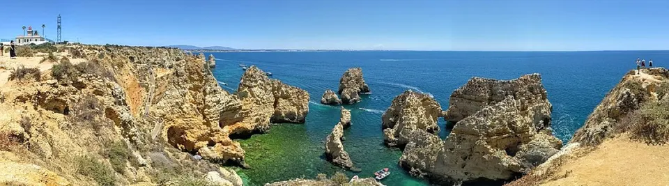
Ponta da Piedade (portugiesisch für „Landzunge der Barmherzigkeit“) ist eine Gruppe von Felsformationen an der Küste der Stadt Lagos in der portugiesischen Region Algarve. Sie bestehen aus gelb-goldenen, klippenartigen Felsen, die bis zu 20 Meter hoch sind, und befinden sich
-
Ponta de Sagres e Cabo de São Vicente
Sagres
Cape near Sagres.
Foto: Ricardo Oliveira, CC BY-SA 3.0 (Wikimedia Commons)
-
Ria Formosa Nature Park
Tavira
Protected area in Portugal.
Foto: Natalia, CC BY 2.0 (Wikimedia Commons)
-
Wasserfall Pego do Inferno in Tavira
Tavira
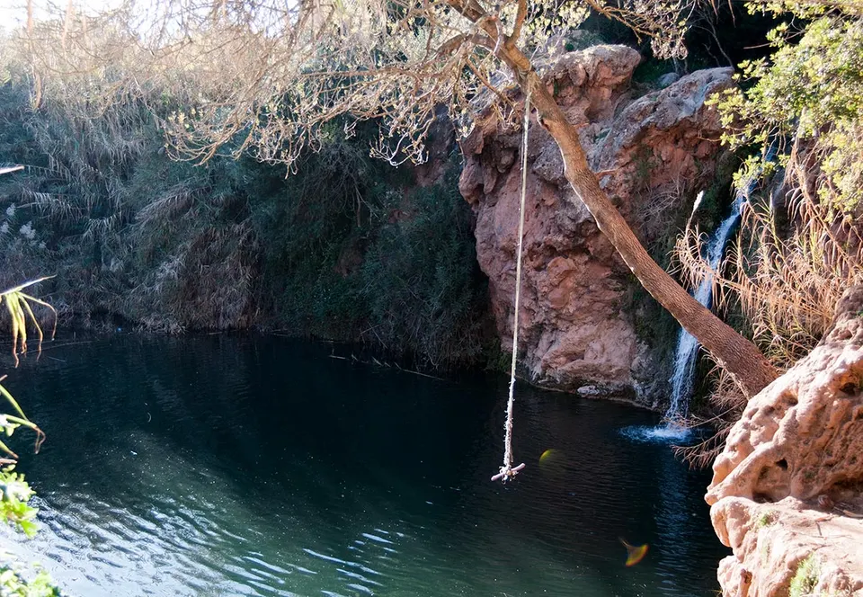
Bei den Einheimischen war er als „geheimer Wasserfall“ bekannt. Heute ist er als Pego do Inferno (Teufelsbecken/Höllengrube) bekannt, was auf eine beliebte lokale Legende über den Ort zurückgeht, nach der eine Kutsche in den See gestürzt sein soll und nie wieder gefunden wurde. Es hieß, dass jeder, der …
-
Área Protegida Privada Vale das Amoreiras
Aljezur
Nature reserve near Aljezur.
© OpenStreetMap contributors (ODbL)
-
Aussichtspunkt Miradouro da Maravilha
Aljezur
Aussichtspunkt in der Nähe von Aljezur.
© OpenStreetMap contributors (ODbL)
-
Aussichtspunkt Ponta da Calheta
Praia da Luz
Aussichtspunkt in der Nähe von Praia da Luz.
© OpenStreetMap contributors (ODbL)